
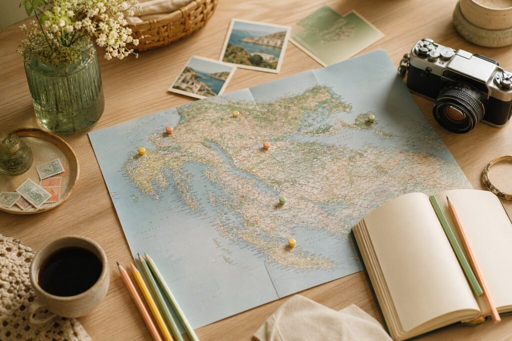
- An interactive map helps to locate Croatia in Europe, understand its regions, and organize a realistic trip with coherent travel times.
- From the mountainous continent to the Adriatic, exploration is thought of in “layers” on the map, between relief, weather, seasons, and current desires.
- Croatian treasures are divided among urban heritage (Zagreb, Split, Dubrovnik), parks (Plitvice, Krka) and island beaches.
- Tourism becomes calmer when the map also helps anticipate the crowd, summer heat, and children’s needs for breaks, water, and shade.
- A “family” approach brings culture to a child’s level with concrete landmarks, short points of interest, and broken-up trips.
Interactive map of Croatia to prepare a calm trip, even with children
When a baby or young child is part of the equation, an “overfull” day often pays off in the evening. Fatigue accumulates, emotional regulation becomes more fragile, and parents find themselves juggling logistics and pleasure. An interactive map changes the game because it instantly makes distances, reliefs, and water points visible, and allows building a trip that breathes.
Croatia is located on the Adriatic coast, at the crossroads of several countries. On a map of Europe, its position is simple. Slovenia to the northwest, Hungary to the north, Serbia to the east, Bosnia-Herzegovina to the southeast, and a border with the latter stretching over a very long length, around 890 km. This geography explains part of the diversity of landscapes. The inland areas are marked by mountains, hills, and valleys, while the coast unfolds a string of bays, ports, and islands.
A well-designed digital map allows layering of information. Parents benefit from using it as a dashboard. The first layer is the relief. Mountain roads can lengthen travel times, even over modest kilometers. The second layer is the season. From May to September, the climate approaches what France experiences, with warm periods along the coast. A child rarely tolerates a mineral visit in full sun without a break. The third layer is concrete needs: toilets, shaded areas, safe swimming spots, parks to stretch legs, and accommodations that allow a nap.
Croatia covers around 56,594 km², compared to 551,695 km² and 3.8 million inhabitants, some areas remain peaceful outside peak summer times, while large tourist sites concentrate the flows. An interactive map showing average attendance, parking, and shuttles in parks becomes a tool to prevent “too late”.
Illustrated maps designed for children also play a role. When a child sees animals, a lighthouse, bike trails, the Adriatic Sea, and some monuments on the map, the trip becomes a story. This anticipation soothes. A young child’s brain loves repetition and predictability. Showing “where” before “doing” reduces the unknown load, thus outbursts at the end of the day.
A cultural detail often helps anchor a destination. Croatia has borne this name in its current form since 1991, after the breakup of Yugoslavia. This detail is not a history lesson. It helps understand why some cities, museums, and monuments speak of reconstruction, identity, and memory. An interactive map that includes short notes, readable in two minutes, makes culture accessible even when parents’ attention is fragmented.
Explore Croatia by regions on an interactive map, from Zagreb to the Adriatic coasts
The capital, Zagreb, is located to the north, more on the continental side. On a map, it plays the role of a logical entry point for arrival by plane or train from Central Europe. In a family itinerary, Zagreb often serves as a buffer. One night on site allows absorbing the trip, buying what’s missing, and setting a pace. Young children need stable references. A late arrival followed by an immediate departure the next morning multiplies the factors for crying and resistance.
On an interactive map, a good strategy is to draw “tolerance circles” around each accommodation. The first circle corresponds to 15-20 minutes of travel. The second to 45-60 minutes. The third beyond 1 hour 30 minutes. The wider the circle, the greater the logistical demand. Parents feel it in their bodies. Breaks become rarer, meals more approximate, falling asleep more difficult. Visualizing these circles on the map provides a simple filter. A museum in the third circle is unlikely to be worth the tension of the evening return.
The Adriatic coast attracts by the obvious beaches and islands. Zadar, Split, Dubrovnik appear as milestones. An interactive map allows choosing a linear progression rather than zig-zagging. Long back-and-forth trips tire everyone and nibble into rest times. Children tolerate a “short and gentle” day better than a “long and spectacular” day. Parents’ memory often follows the same logic.
A useful point for tourism in 2026 concerns heat and hydration. The Adriatic sun can be intense in the heart of summer. An interactive map showing beaches with shaded areas, presence of a café, stroller access, and shallow water saves a huge amount of time. Safety is worked on in advance. Clear water sometimes gives an illusion of shallow depth. Checking the marked zones on the map and on site reduces unintentional risks.
The map is not only for “seeing.” It helps distribute mental load. One parent can keep the main itinerary, the other spot backup plans. A playground, a bakery, a shaded park. This sharing avoids the feeling of being alone carrying the trip. The parental couple, when tired, benefits from this simple organization. Orientation tensions are rarely “just” about orientation. They affect the sense of control.
To contextualize budget differences, the cost of living in Croatia was observed to be around 28% lower than in France according to 2023 estimates, with significant variations depending on season and tourist areas. In 2026, the gap may narrow in highly frequented places in summer. An interactive map with average price markers by neighborhood or by beach type helps to arbitrate without frustration. Parents benefit from planning a margin for simple impromptu meals. A child refusing a dish due to heat or fatigue is not “difficult.” Their regulation system responds to context.
The next section can go further, using the map as a sensory orientation tool. Parks, water, waterfalls, and forests speak to the body. This dimension changes the quality of the stay.
To extend symbolic reading of colors and visual cues on a map, some families also like to link with other flags and their codes. A clear resource on this subject is found here history of the French flag colors, useful to simply discuss symbols with a curious child.
Natural treasures on the map of Croatia, from Plitvice to Krka, with concrete landmarks
National parks and protected areas are very clearly marked on a map of Croatia. Two names often come up because they offer relatively simple access and immediately striking landscapes. The Plitvice Lakes National Park and the Krka park are recognized as major landmarks, with marked trails and observation points.
What changes everything, with children, is rhythm management. Waterfalls and footbridges invite walking for long periods. Toddlers, however, have a limited attention span. An interactive map indicating loop lengths, elevation gain, and rest areas allows adjustments. A 3 to 5 km route can already be a long day if a child walks in bursts, stops frequently, or asks to be carried. The map becomes a tool to prevent overload, just like a water bottle or a cap.
Another concrete point concerns water. In many families, swimming in authorized zones is a strong regulator. Contact with water, temperature, the constant noise of waterfalls all support the nervous system. A child who becomes restless after several urban visits can regain amazing availability after half an hour near a watercourse, without even speaking. This mechanism is simple. Less unpredictable stimulation, more regular and rhythmic stimuli. The interactive map helps find these areas without wandering.
Season, crowd, and shade markers for outings that remain pleasant
Between May and September, the days are conducive to outdoors. Hours matter. An early morning park visit reduces the crowd and avoids midday heat. An interactive map showing secondary entrances, the closest parking lots, or shuttles helps avoid a long endless approach walk. Fatigue is not always visible at the start. It often explodes on return.
Parents can also use the map to break up the day. A morning at the park, a nap at the accommodation, then a short outing late afternoon. This rhythm better respects the needs of young children. A “non-stop” day can be managed once, but it often requires two days of emotional recovery.
Orientation table to choose treasures according to age and day’s energy
| Type of treasure | What the interactive map helps identify | Why it is suitable (or not) with children | Concrete indicator to adjust |
|---|---|---|---|
| Waterfall park (Plitvice, Krka) | Loop length, elevation gain, rest points, limited stroller access | Very stimulating but can become exhausting if the walk exceeds tolerance | A child stumbling more, rubbing eyes, or frequently asking to be carried |
| Calm beach | Shaded areas, slope into the water, presence of toilets and water point | Strong sensory regulation, simple play, recovery | Irritability that decreases after 20-30 minutes of repetitive play near the water |
| Old town and heritage | Pedestrian streets, stairs, parking, nearby viewpoints | Very rich culturally but increased fatigue with heat and crowd | Sudden opposition, refusal to walk, hypersensitivity to noise |
| Island (Hvar, Mljet) | Ferry schedules, port, crossing time, accessible beaches | Great if timing respects meals and naps, difficult if waiting is long | Crying at the end of the queue, agitation in confined spaces |
This table serves as a reference, not a rule. A child may love walking one day and refuse the next. The interactive map has a discreet advantage. It makes plan changes easy without feelings of failure.
The next step, for many families, is to include cities without exhausting everyone. The map then becomes a tool for micro-itineraries, almost like a thread of Ariadne.
Croatian heritage, culture, and tourist sites, using the interactive map as a guide
Croatian heritage is read in layers. Coastal cities bear Venetian, Roman, and Mediterranean influences. Continental cities tell other stories, more centered on Central Europe. An interactive map, when offering concise historical cues, helps connect these layers without overwhelming the visitor. Parents do not need a lecture. They need a reading key in a few lines, at the right moment.
Split is often chosen for its position and urban energy. Dubrovnik for its visual power and status as an emblematic site. Zadar for a softer atmosphere depending on neighborhoods. On a map, the interest is to spot nearby viewpoints, accessible wall segments, and seaside promenades that allow a break. A successful urban visit with a child often relies on a simple alternation: fifteen minutes walking, five minutes stopping. An interactive map with “pause pins” makes this alternation possible without stressful improvisation.
Culture is also transmitted through the sensory. A shaded square to listen to a musician, a market to smell fruits, a small port to watch boats. Children learn by observing and repeating. The map can become a language support. Showing the Adriatic Sea, then walking to the shore, links the symbol and the real. This coherence calms and structures.
A short list to build an urban day respecting family rhythm
- Choose a single “major” tourist site and surround it with two identified breaks on the map, less than 10 minutes’ walk each.
- Plan sun exposure by favoring alleys and shaded places between 12 p.m. and 4 p.m., especially in July-August.
- Provide a visible escape route on the map, like a park, a waterfront promenade, or a café with toilets.
- Break up trips by locating parking or transport stops that avoid a long bad-timed walk.
This approach has a very concrete effect. Parents feel less “trapped” by a program. The child keeps energy for the evening. Tensions often decrease when the day has a stable structure.
Islands and coastline, treasures that are earned but must be prepared for
Islands attract because they promise a form of parenthesis. Hvar is known for its liveliness. This reality can be an asset or a constraint depending on place and time. An interactive map helps choose accommodation in a calmer zone, away from nightlife routes. Mljet is sought after for its more peaceful landscapes and attractive waters. Again, the key is to spot crossing times, waiting times, and meal plans. A child skipping a meal or waiting too long in heat is not “fussy.” Their regulation system struggles.
Two links between heritage and daily life deserve to be visible on the map. Fountains, markets, seaside promenades. These places are less “prestigious” on paper but often make the quality of a family trip. An interactive map allowing to save personal points, with notes “break,” “shade,” “stroller,” becomes a living logbook.
The next step is to talk about budget without reducing Croatia to a price comparison. A map can also serve to protect against unwanted spending, those that occur when everyone is exhausted.
Some parents appreciate having a reference on how a country tells its identity through symbols and colors. An accessible reading of these mechanisms, even for talking to a child, is found here the colors of the flag explained simply, and the discussion can then return to Croatian visual codes observed on site.
Tourism in Croatia in 2026, budget, periods, and family comfort guided by an interactive map
Croatia is often seen as a “nearby” destination from France, encouraging stays of varied duration. The most sought-after period remains the window from May to September, for good weather and swimming. This appeal has a downside. Prices rise in highly demanded areas and roads can get congested. An interactive map showing nearby alternatives helps keep the same pleasure without imposing the same density.
The budget is built by items: accommodation, meals, transport, activities. The estimated cost of living gap in 2023 around 28% lower than in France must be read cautiously, because reality varies by cities, islands, and season. In summer, some coastal neighborhoods can approach Western European standards. The interactive map, if enriched with price markers or at least types of places, helps decide. A beach that is free but without shade can end up costing a lot in “survival” consumptions if everyone seeks refuge. Conversely, a place with shade, toilets, and water allows staying long without extra expense.
An under-discussed aspect concerns decision fatigue. The more parents choose “last minute,” the more they spend energy, then money. An interactive map allows pre-deciding. Three options for half a day, no more. An option A, a B, and a fallback option C. This simplicity does not impoverish exploration. It makes it feasible.
Island transport deserves special attention. A ferry crossing is not complicated, but waiting can be, especially with heat and crowd. Spotting a shaded spot near the port, a bakery, and a space to move changes the experience. Children tolerate waiting better when they can alternate immobility and movement. The brain needs this alternation to avoid overload.
The “most beautiful place” is not a single point. Plitvice and Krka are very photogenic and easily identifiable on a map. Island beaches, some old town alleys, inland valleys, can become stronger memories because they match the family’s real rhythm. The interactive map helps find what resembles the family, rather than a standard image of travel.
Consultation box, when the trip becomes too heavy for the body or health
A trip sometimes highlights a health issue in a child or parent. An on-site consultation or medical advice becomes relevant if one of the following signs appears: persistent fever in a young child, unusual sleepiness or lasting inconsolability, signs of dehydration such as a very dry mouth and rare urination, breathing difficulty, intense pain not relieved with rest, or repeated vomiting. A parent in marked exhaustion, with dizziness, faintness, or overwhelming anxiety, also deserves professional support. The interactive map can then help quickly locate a pharmacy, a health center, or a hospital without waiting for the situation to worsen.
After these landmarks, the last useful part is to answer frequently asked questions, those that come up when packing the suitcase and planning the itinerary.
What is the capital of Croatia and why place it at the beginning of an itinerary?
The capital is Zagreb. Placing it at the start of the stay often allows absorbing the trip, taking a gentler pace, and beginning exploration with a continental city before heading down to the coast. With children, this step reduces accumulated fatigue which then complicates visits.
What period to choose to enjoy the beaches without facing the crowds?
Between May and September, good weather is frequent. To limit attendance, many families appreciate late May-June or September, when the water remains pleasant and tourist sites are less saturated. An interactive map helps spot calmer coves and beaches with shade and easy access.
Which natural treasures should be prioritized on a map of Croatia?
The Plitvice Lakes National Park and Krka Park are major landmarks, easy to identify on a map and known for their waterfalls. The interactive map helps choose a suitable circuit considering length, elevation gain, and rest zones.
Is life expensive in Croatia for a family trip?
Estimates have long placed the cost of living in Croatia below France, by about 28% less according to 2023 data. In practice, very touristy coastal areas in summer can be more expensive. An interactive map helps choose nearby alternatives and avoid expenses related to fatigue, such as spontaneous meals due to lack of organization.